Ontario QEW Photos
The Queen Elizabeth Way links Toronto with the Niagara Falls region
of Ontario, including the international border crossings along the
Niagara River to New York. As such, it is a popular route for holiday
traffic and international commerce.
The definitive history of the QEW is at Chris Bessert's Ontario Highways. Note that the road is named
for the late Queen Mother and not the current British monarch (who had
not yet ascended to the throne when the route was opened in 1939).
Also unusual for a North American highway is the use of control
cities, rather than cardinal directions, as the primary directional
indication: one doesn't go "East" or "West" on the QEW; instead, one
goes toward Fort Erie, "Niagara," or Toronto.
Today, the QEW has mostly been upgraded to a modern freeway.
Long-term plans call for a parallel, probably tolled, "Mid-Peninsula
Corridor" between Fort Erie and the 407 toll route to relieve traffic
congestion on the route.
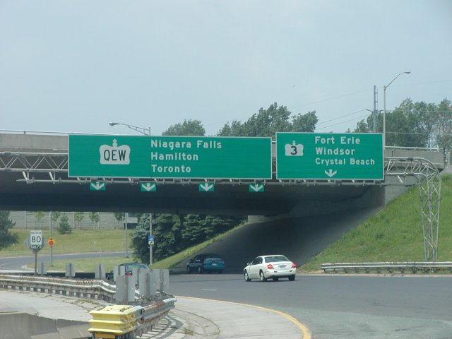 |
| The first interchange on the Toronto-bound QEW is an exit for
Former Hwy 3, which connects Fort Erie with the Windsor/Detroit region
of southwest Ontario. While these days most Detroit-bound traffic
would probably continue on the QEW to Hwy 403, Hwy 3 is still an
important regional route. Note the lack of an exit number tab on the
overhead sign, and the three control cities for the QEW. Also note
the design of the downward-pointing arrows, and the speed limit sign
under the overpass. |
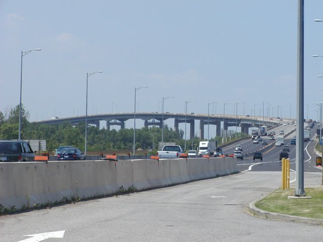 |
| The Garden City (Homer) Skyway takes traffic across the
Welland Canal. More information on the Skyway is at Chris
Bessert's site. This photo is taken from the Ontario Tourist
Information Center just west of the Hwy 405 merge between
St. Catharines and Niagara Falls. |
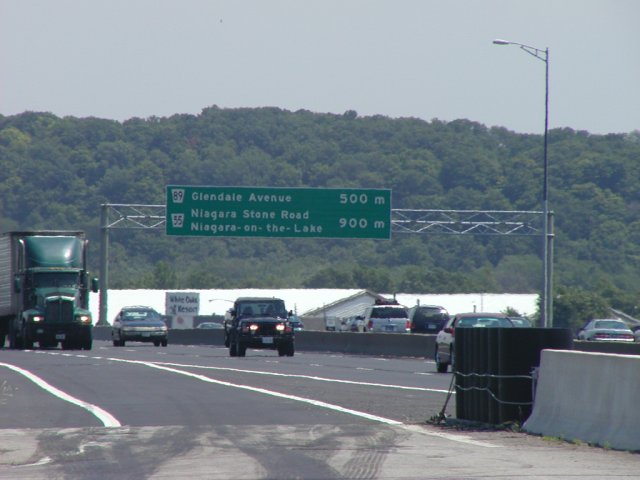 |
| Two exits in rapid succession produce this unusual overhead
sign configuration; a U.S. design would probably have two separate
signs next to each other, one for each exit. (Also note the
American-style truss, instead of the more curved truss that is
typically used.) |
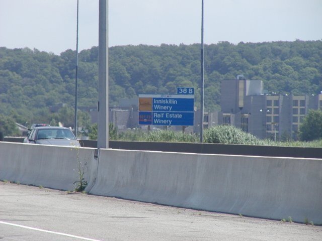 |
| Typical attraction signage in Ontario. Note the exit tab
and the use of the business's logos - some signs even include
marketing slogans in the text. Also, note the use of the
Swiss/Helvetica font, rather than the (U.S.) FHWA Series font normally
used on freeway signage. |
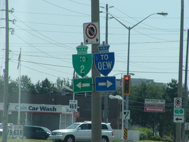 |
| Typical Ontario trailblazer designs (taken in Burlington); a
specially-colored shield is used instead of the ordinary shield color.
Also note the blue trailblazer for the QEW, which is only used for
this route (all other trailblazers are green). |
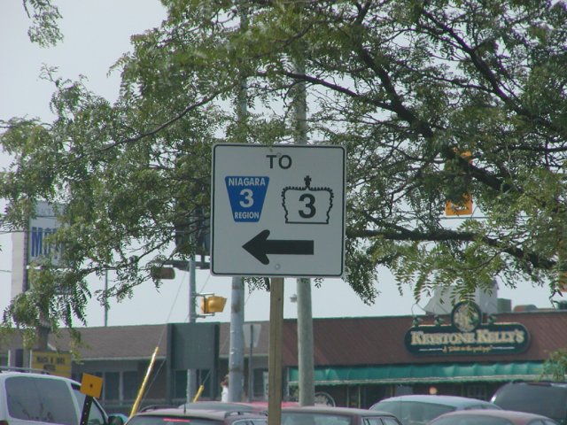 |
| Signage for Niagara Regional Road 3, which turns into Ontario
Hwy 3 several miles to the west. |
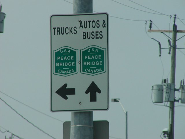 |
| Some signage for the Peace Bridge in Fort Erie; note the
different route for trucks, as they must enter the QEW further west to
access the Customs Canada preclearance lanes at the bridge. |
Back to my Ontario road photos collection.
Chris Lawrence <chris@lordsutch.com>
(9 Mar 2006 at 23:11 EST)


